

Planning a trip to the Oregon coast? Don’t forget to check the Cannon Beach Tide Chart — your essential guide to unlocking the best coastal experiences. Whether you’re dreaming of walking out to Haystack Rock, exploring colorful tide pools, or capturing stunning sunrise reflections, the Cannon Beach Tide Chart helps you time it perfectly.
With ocean levels rising and falling twice daily, knowing when low and high tides occur can make or break your beach day. The Cannon Beach Tide Chart isn’t just for surfers or scientists.
It’s for every traveler who wants to stay safe and make the most of this breathtaking destination. By syncing your plans with the tide schedule, you’ll discover a hidden world of marine life and wide-open beaches waiting just below the surface. Don’t leave it to chance. Let the Cannon Beach Tide Chart guide your adventure.
Understanding Tide Charts
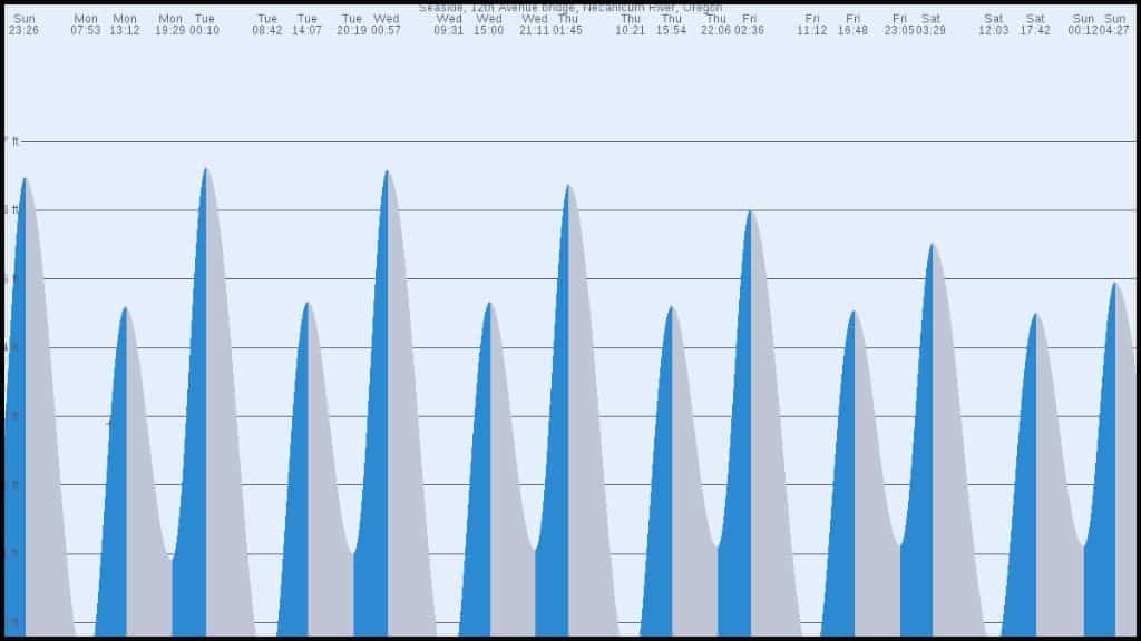
A tide chart provides daily predictions of high and low tides, indicating the times and heights of each. Cannon Beach experiences a semi-diurnal tide cycle, meaning there are two high tides and two low tides approximately every 24 hours. These fluctuations are influenced by the gravitational pull of the moon and sun, as well as the Earth’s rotation.
Reading a tide chart involves noting the times of low and high tides and their corresponding heights. Negative tide heights, known as “minus tides,” occur when the water level falls below the average low tide mark, exposing more of the intertidal zone. These periods are ideal for exploring tide pools and marine life.
Cannon Beach Tide Chart 2025
Planning a visit to Cannon Beach in 2025? Understanding the tide schedule is essential for making the most of your coastal experience. Whether you’re interested in exploring tide pools, photographing Haystack Rock, or simply enjoying a walk along the shore, knowing the timing of high and low tides can enhance your visit.
Accessing the 2025 Cannon Beach Tide Chart
For accurate and up-to-date tide information for Cannon Beach in 2025, consider the following resources:
- NOAA Tide Predictions: The National Oceanic and Atmospheric Administration provides detailed tide predictions for various locations, including Cannon Beach.
- Cannon Beach Chamber of Commerce: Their official website offers tide charts and additional information to help plan your activities.
- Oregon State Parks: They publish annual tide tables, which can be a valuable resource for visitors.
By consulting these resources, you can ensure a safe and enjoyable experience at Cannon Beach, making the most of what this beautiful coastal destination has to offer.
Related: Cannon Beach Oregon
Cannon Beach Tide Times, Oregon (May 26 – June 1, 2025)
| Date | High Tide (ft) | Time | Low Tide (ft) | Time |
| Mon, May 26 | 9.88 ft | 12:16 AM | -1.94 ft | 7:22 AM |
| 7.25 ft | 1:41 PM | 2.99 ft | 7:09 PM | |
| Tue, May 27 | 10.14 ft | 1:01 AM | -2.3 ft | 8:12 AM |
| 7.28 ft | 2:32 PM | 3.18 ft | 7:59 PM | |
| Wed, May 28 | 10.14 ft | 1:48 AM | -2.3 ft | 9:02 AM |
| 7.19 ft | 3:22 PM | 3.31 ft | 8:51 PM | |
| Thu, May 29 | 9.88 ft | 2:35 AM | -2.03 ft | 9:50 AM |
| 7.09 ft | 4:11 PM | 3.44 ft | 9:44 PM | |
| Fri, May 30 | 9.32 ft | 3:23 AM | -1.48 ft | 10:38 AM |
| 6.96 ft | 5:02 PM | 3.54 ft | 10:38 PM | |
| Sat, May 31 | 8.6 ft | 4:13 AM | -0.79 ft | 11:25 AM |
| 6.92 ft | 5:54 PM | 3.64 ft | 11:37 PM | |
| Sun, Jun 1 | 7.74 ft | 5:07 AM | 0 ft | 12:13 PM |
| 6.99 ft | 6:46 PM | — | — |
Note: All times are in Pacific Daylight Time (PDT).
Tips for Using the Tide Chart
- Tide Pooling: Aim for low tides, especially those with negative values (minus tides), as they expose more of the intertidal zone, revealing diverse marine life.
- Photography: Low tides during sunrise or sunset provide expansive reflective surfaces and unique compositions, particularly around Haystack Rock.
- Safety: Always be aware of the tide schedule to avoid being caught by rising waters, especially when exploring areas that may become isolated during high tides.
Why Tides Matter at Cannon Beach?
Cannon Beach, Oregon, is a coastal gem renowned for its stunning landscapes, iconic Haystack Rock, and vibrant marine life. Understanding the tide patterns is essential to fully appreciating its natural beauty. The Cannon Beach Tide Chart serves as a vital tool for visitors who want to plan their activities around the ebb and flow of the Pacific Ocean.
Tide awareness is crucial for several reasons:
- Safety: Rising tides can quickly cover areas that were previously accessible, potentially stranding unaware visitors.
- Tide Pool Exploration: Low tides reveal a plethora of marine life around Haystack Rock, including sea stars, anemones, and crabs.
- Photography: Low tides offer expansive reflections and unique compositions, especially during sunrise and sunset.
- Beachcombing: The receding tide uncovers shells, driftwood, and other treasures along the shoreline.
Related: Top 7 Romantic Vacations in Oregon
How to Read a Cannon Beach Tide Chart?
Reading a tide chart might seem technical at first, but it’s a simple and essential skill for anyone planning a trip to Cannon Beach. Tide charts show the daily rise and fall of the ocean, indicating the exact times and heights of high and low tides.
Understanding this information helps you time your beach activities for safety and enjoyment, especially if you’re exploring tide pools, photographing Haystack Rock, or walking along the shore. With a little practice, reading a Cannon Beach tide chart becomes second nature and transforms your coastal visit into a well-timed adventure.
To effectively use a tide chart:
- Identify Low Tide Times: Look for the times when the tide is at its lowest.
- Note the Tide Heights: Lower tide heights (especially negative values) indicate more exposed beach areas.
- Plan Accordingly: Aim to arrive at the beach at least an hour before the predicted low tide to maximize exploration time.
Best Times to Visit Based on Tides
The optimal times to explore Cannon Beach’s intertidal zones are during low tides, particularly minus tides. These typically occur during the spring and summer months. For instance, on Tuesday, May 27, 2025, a low tide of -2.3 ft is expected at 8:12 AM, making it an excellent opportunity for tide pooling.
Planning visits around these times ensures safer and more rewarding experiences, whether you’re exploring tide pools, photographing the landscape, or simply enjoying a beach walk.
Read More: Best Things To Do in Oregon
Additional Tips for Coastal Safety and Fun
Exploring the scenic beauty of Cannon Beach is a rewarding experience, but to make the most of your visit, it’s essential to stay safe and prepared. The coastal environment can be unpredictable, with changing tides, slippery rocks, and sudden weather shifts.
Whether you’re tide pooling, hiking along the shoreline, or simply soaking in the views, a few key precautions can go a long way in ensuring your adventure remains both safe and enjoyable. Here are some practical tips to help you navigate the beach with confidence while maximizing the fun.
- Stay Informed: Always check the latest tide charts and weather forecasts before heading out.
- Wear Appropriate Footwear: Sturdy, waterproof shoes can protect against slippery rocks and sharp shells.
- Be Mindful of Wildlife: Observe marine life without disturbing their natural habitats.
- Never Turn Your Back on the Ocean: Sneaker waves can occur unexpectedly; always stay alert.
Read Also: King Tides Oregon Coast
Where to Find the Cannon Beach Tide Chart?
When planning a trip to Cannon Beach, timing your visit around the tides can make all the difference, especially if you’re hoping to explore tide pools, photograph Haystack Rock, or simply enjoy a safe beach walk. Knowing where to find accurate and up-to-date tide information is essential.
Fortunately, several reliable sources offer detailed tide charts tailored to Cannon Beach, helping visitors plan their coastal adventures with precision and confidence. From official government sites to user-friendly local platforms, accessing the right tide chart has never been easier.
Reliable tide information can be accessed through:
- NOAA Tide Predictions
- Cannon Beach Tide Charts
- WillyWeather Cannon Beach Tides
These resources provide up-to-date tide times, heights, and additional information to help plan your visit.
Conclusion
Understanding and utilizing the Cannon Beach tide chart enhances your coastal adventures, ensuring safety and enriching your experience. Whether you’re a seasoned beachcomber or a first-time visitor, aligning your activities with the tides unlocks the full splendor of Cannon Beach’s natural offerings.
To Know More: Oregon Road Trip Ideas and Tips
Frequently Asked Questions (FAQs)
Here are you find a few commonly asked questions about the Cannon Beach Tide Chart, each with a clear and informative answer:
What is a tide chart, and why is it important for Cannon Beach?
A tide chart shows the predicted times and heights of high and low tides throughout the day. At Cannon Beach, this information is crucial for planning activities like tide pooling, beachcombing, and photography, and for ensuring safety when exploring areas around Haystack Rock and the intertidal zone.
How do I read the Cannon Beach tide chart?
Tide charts typically list times and heights of high and low tides. High tides are the times when the water level is at its peak, while low tides reveal more of the shoreline. Negative tide values (e.g., -2.3 ft) mean especially low tides — perfect for tide pooling.
When is the best time to visit Cannon Beach for tide pooling?
The best time is during low tides, particularly during “minus tides,” when the water retreats far enough to expose marine life near Haystack Rock. These usually occur a few times a month, especially in the spring and summer.
Are tide times the same every day at Cannon Beach?
No, tide times and heights change daily due to the moon’s phases and other tidal forces. That’s why it’s important to consult a current tide chart before planning your activities.
Where can I find an accurate Cannon Beach tide chart?
Reliable sources include:
- NOAA Tide Predictions
- CannonBeach.org
- WillyWeather Cannon Beach Tides
These platforms provide daily and monthly tide data specific to Cannon Beach.
Can I access the tide chart offline?
Yes, you can download or print a PDF version of the tide chart from websites like the Oregon State Parks or Cannon Beach’s official site. This is especially helpful if you’re heading to the beach without cell service.
What safety tips should I follow based on the tide chart?
Always arrive before low tide and leave before high tide returns. Avoid venturing too far out on rocks or sandbars, and never turn your back on the ocean. Sudden changes, such as sneaker waves, can occur even during low tide.


")


[…] Read: Cannon Beach Tide Chart […]
Comments are closed.