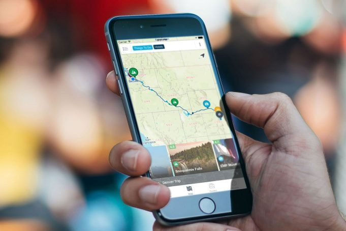
Backpacking in anticipation of new wanderings? Got your maps? Or do you prefer sites or mobile apps with bright images and numerous features, whose interfaces are as user-friendly as betamo.com or even Netflix? Here are the most popular maps for orienting yourself when you’re camping.
Paper Maps
The classic of tourism is still alive today. Paper doesn’t need the Internet, doesn’t waste battery power, and in general gives the opportunity to take a break from gadgets and feel like a discoverer from the past. It’s edited with a simple pencil, decorated with flags and proudly hangs on the wall. It unites you on a hike: you can bend over a huge map as a group – not like over a smartphone.
Unfortunately, the disadvantages are obvious. Maps get wet, crumpled, and eventually become irrelevant. So if you buy such a map today, but want to travel next summer, it’ll be hard to navigate through that city, forest, or another area.
Maps Me
The app is based on OpenStreetMap. The app is best used as a navigator for pedestrians and motorists. In some cities, it displays public transport. Moreover, it contains voice instructions. You can enable night mode and 3D format. Maps of many foreign cities are drawn.
The app shows the current speed, kilometers traveled and the remaining distance contains zoom buttons, and saves the recent journey up to 1 day. Low battery consumption is ensured. The app allows you to download any number of maps for free and update them frequently. It displays altitude lines, but cannot boast the detail of the route with the display of heights and Charter Spectrum.
One of the big pros is a clear interface. But maps.me doesn’t see all the trails.
The app is available for editing. This is both a benefit and a catch since people tend to make mistakes. What’s more, some objects (springs, drying rivers) are seasonal or disappear over time, and the information about them may not be up to date until the next edit.
No matter how perfect the app is, the GPS may glitch, and your location won’t be detected correctly. In order not to get lost, it’s important to know how to navigate yourself by correlating natural objects to the map.
Fatmap
The main feature of the app is a three-dimensional map, making using it as fun as playing at betamo.com. It’s convenient for orientation in the mountains. You can overlay layers with elevation lines, and information about slopes and flat areas – just right for hiking.
You can use offline maps and layers only for money. The paid version is set at once for a year, but you can test for free for 7 days.
Spyglass
The app is distinguished by the accuracy of navigation. It clearly finds the location in the open terrain. It helps leave markers (such as a tent or a car) and find the way to them.
It contains several types of maps and coordinates, compass and gyrocompass, GPS navigator, waypoint tracker, altimeter, sextant, speedometer, and rangefinder. This rich toolkit will be even more valuable if you know how to use the compass without the app.
Moreover, it calculates the exact location of celestial luminaries and helps to adjust the compass by them.
One of the nicest features is camera shots with GPS overlay.
Brief Summary
The good old paper map won’t be out of use for long. The large format is more convenient to view, and it will help if your phone dies, breaks, or gets lost, especially on complicated, self-contained routes.
Apps allow you to share GPS coordinates, which means you can report yourself to civilization if you get lost on the route. Simple mobile map designations require no knowledge of topography, and descriptions of objects are convenient to use for route planning.





![What to Wear When Hiking in Summer [Stay Cool and Comfy] What to Wear When Hiking in Summer](https://tourinplanet.com/wp-content/uploads/2023/10/What-to-Wear-When-Hiking-in-Summer-238x178.jpg)


![What Does Aviates Stand for in Aviation? [The Art of Flying] Aviates](https://tourinplanet.com/wp-content/uploads/2024/07/Aviates-100x75.jpg)




![25 Best Peruvian Foods You Must Try In Peru [With Recipes] Peruvian Food](https://tourinplanet.com/wp-content/uploads/2024/07/Peruvian-Food-100x75.jpg)


